What's new
  • ICMag with help from Landrace Warden and The Vault is running a NEW contest in November! You can check it here. Prizes are seeds & forum premium access. Come join in!

Geography, History and Human Universal Culture:

tobedetermined

Well-known member
Premium user
ICMag Donor
What is the lower and center piece, which shows holes?
Could you specify the temporal and geographical context, if possible?

Clockwise from top left: scraper, sharpening stone, decorated rim of a pot, stone tool, half of the bowl of a pipe, poor quality flint arrowhead
All are from the Late Woodland Iroquois Confederation 800ce – 1650ce

I found them all as the sod was stripped off 3 adjacent fields with a tributary of the Rouge River in the middle. The charcoal stain of two longhouses was visible in one field – where I found the pottery, which is one of several pieces. The terracotta pipe bowl is darkened on the inside and you can see a faint indentation from a hollow stick that was used as a stem.

And btw . . . it is all a subdivision now.

pipe4.jpg
 
Last edited:

tobedetermined

Well-known member
Premium user
ICMag Donor
illuminating, at the least. i've read extensively about the early Ameri-Indian cultures for years, but had not run across (or did not remember) any references of them smelting copper

The Maya and Inca were extremely proficient at soft metals - gold and silver - so that would qualify. The NA tribes worked copper but never really smelted it afaik.
 

Montuno

...como el Son...
Yes, Coronado explored out there before Escalante. De Soto wandered around the west coast of Florida up to N Florida, the Southeast USA, and as far as Texas. One of your references mentions Lake Jackson mounds which are just a few miles south of here. The Spanish went through hell in Florida.

(1)- Exploration and conquest of Florida​

Posted on22 February, 2017by laamericaespanyola
1513_america-admirals-map-walseemuller Map of the 'Terra Nova' drawn by Waldseemüller in 1513
The exploration and conquest of Florida by Spain, an indomitable territory where all the elements were against it, was a huge and amazing undertaking.
Of all the great territories, such as Mexico, Peru, Tierra Firme , Chile, Río de la Plata, California and Florida, in which Spain served in continental America for more than three centuries, the latter takes the honor of maximum difficulty.
In 1513 Spain had discovered all the islands of the Caribbean Sea, the coast of Tierra Firme from the Guyanas to Cabo Gracias a Dios between Honduras and Nicaragua and that same year in September, Núñez de Balboa would discover the long-awaited South Sea.
In the first years after the discovery, in addition to exploring the Antilles and Tierra Firme up to the mouth of the Orinoco, Américo Vespucio toured the Brazilian coast and was the first to announce that what had been discovered was a new continent. Vicente Yáñez Pinzón had reached the mouth of the Amazon in 1500 and Juan Díaz Solís in 1508 had explored Yucatan and traveled part of the coast of Mexico.

The explorations of the last decade of the fifteenth century and the first two of the sixteenth, were characterized by coastal navigation, with hardly any attempt to deepen into the new continent or colonize it, since priority was given to the company of finding a passage that would lead without more delay to the riches of the East Indies, which were supposed to be very close.
Some ephemeral settlements were founded in those years, more with the aim of facilitating successive jumps to more advanced borders than with the idea of colonizing the new continent. bimini top https://laamericaespanyola.files.wordpress.com/2017/02/bahamap.gif
At the beginning of the 16th century, one of Emperor Charles V's cartographers and cosmographers identified a tongue of land located to the north of the island of Cuba, relating it to Bimini Island , named after the Carib Indians.
Juan Ponce de León , who had been the first Governor of the island of Puerto Rico, also received the news that there was on a certain island of the Lucayas archipelago a fountain, river, lagoon or spring, whose prodigious waters restored vigor, the freshness and arrogance of youth to those who bathed in them. Some Indian chiefs, eager for a rejuvenating bath, claimed that the island of the fountain of youth was nearby.

In a memorial addressed to the king on June 30, 1511, Ponce de León had expressed his interest in exploring these islands located north of the Lucayas , obtaining royal permission in February 1512.
Ponce prepared this expedition on the island of Hispaniola , from where he departed from the port of Yuma with two caravels englishroutemap_0 ( Santiago and Santa María de la Consolación ) to go first to Puerto Rico , where in the port of San Germán he rigged a third caravel (nao San Cristóbal ) as captain.
On March 3, 1513, Ponce de León 's expedition sailed NW from San Germán, anchoring for the first time on the 9th in Babueca ( Turks and Caicos Islands ).
They continued sailing through the intricate labyrinth of islands, until they reached Guananahí (San Salvador or Watling), where they careened one of the ships and found no human beings.
ponce_de_leon_map

Continuing to the NW, and after bordering Little Bahama to the east, on March 27 they sighted a "great green island" which they called La Florida because it was the Easter holiday, but they were unable to disembark until very far away. north on April 2, taking solemn possession of the land in the name of the King of Spain on April 8.

The three ships that made up the expedition then headed south, sailing along the east coast, and a few kilometers away they discovered a cape of land that jutted out into the ocean, which they called Cape Canaveral, because the reeds and reeds had a similar shape to sugar cane. After a few more hours of travel, they anchored in a river they called Santa Cruz ( Jupiter Inlet ), where the sailors collected water and wood for repairs.
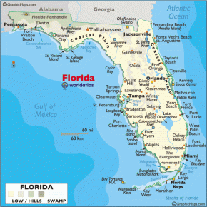
What they had actually discovered and were exploring was a peninsula, and it was populated by different groups of indigenous people. In the north, from west to east: Apalaches, Guales and Timucuas and in the south bordering the coast from west to east: Tocobagas, Calusas, Tequestas and Ais.
On April 20 they anchored off a coast where native huts could be seen, probably Tequestas. There they verified their aggressiveness and hostility. After having a skirmish with them, they re-embarked keeping the south course, but with great difficulty because they did it against the Gulf Stream and the fleet could hardly overcome the strong currents despite the fact that they had the wind in their favor.
154367727f4c04a6f1db3afcc1af6e89-jpeg

This is how the chronicler Antonio de Herrera narrated in his " General History of the Acts of the Castilians in the Islands and the Firm Land of the Ocean Sea" (published in 1601 and known as Decades) what is considered the first written evidence of the current of the Gulf : « The next day going by the edge of the sea, they saw a current that, although they had a long wind, they could not go forward, but behind, because there the water runs so much that it has more force than the wind, and does not let go the ships ahead; and at last it was known that the current was so great that it was stronger than the wind» .
 

Montuno

...como el Son...

(2)- Exploration and conquest of Florida​

Posted on22 February, 2017by laamericaespanyola

One of the three pilots of the expedition was Antón de Alaminos , considered along with Ponce de León , as the co-discoverer of the Gulf Stream ( Gulf Stream ), and the first who knew how to take advantage of its advantages for navigation. It was a
biscayne_bay_map
transcendent discovery that the mass of warm water that flows from the Gulf of Mexico to the North Atlantic and that, passing between Cuba and the Florida peninsula, reaches northwestern Europe (a vital discovery for the fleets) was discovered and documented. and one more reason for the future Spanish control of Florida).


On May 13 they arrived at a bay where they spotted an indigenous settlement, surely where Key Biscayne and its bay ( Biscayne Bay ) are today, land of the Tequesta natives, where they mapped it and Ponce claimed the island he named Santa Martha.

flcolor


Between May 15 and 16, they skirted the southern keys that he called "Los Mártires", and finally turned north to double the western coast, pass by Cabo Romano and reach San Carlos Bay (Charlotte Harbor ), landing on May 23 (reportedly at the mouth of the Caloosahatchee River ) to careen one of his ships.


On June 3 they were attacked, this time by the Calusa, who surprisingly insulted them in Spanish, a language probably acquired from the natives who fled from Cuba, killing a Spaniard. On June 6 they suffered a second attack, so they re-embarked a few days later.


meeting-of-the-calusa-indians-with-ponce-de-leon-in-1513-illustration-by-merald-clark
Encounter of the Calusa Indians with Ponce de León in 1513. Illustration by Merald Clark
Thus, on June 14 they decided to return and head south and on the 21st they discovered some uninhabited islands that they called Tortugas ( Dry Tortugas) because they captured turtles and birds there.

After resupplying in Havana, they explored the rest of the Lucayas, landing on another large island called Gran Bajamar (Grand Bahama), passing through the islands of New Providence, Eleuthera, and Andros, among others, and arriving in Puerto Rico on October 13. from 1513.
 
Last edited:

Montuno

...como el Son...

(3)- Exploration and conquest of Florida​

Posted on22 February, 2017by laamericaespanyola

Since then, numerous exploring expeditions tried with negative results to settle in this territory, until in 1565, Pedro Menéndez de Avilés succeeded, settling definitively on the Atlantic coast, as a result of a colonization attempt by France.


Two of these expeditions made it to the Atlantic coast of the peninsula (Esteban Gómez and Vázquez de Ayllón) and seven to the western coast that is part of the Gulf of Mexico (Hernández de Córdoba, Pineda, Ponce, Narváez, De Soto, Las Bazares and Moon):

In 1517 Francisco Hernández de Córdoba, returning from the Yucatán together with Antón de Alaminos , replenished provisions on the Florida coast. They had to leave before the attack of the natives.
5015_mapapineda


In 1519 Álvarez de Pineda sailed along its western coast, and by completing the exploration of the Gulf of Mexico , he demonstrated its continentality.


In 1521 Ponce de León made his second expedition with colonizing intention, leaving in two caravels
ruestebangomez
with 200 men and 50 horses. He headed this time for the west coast, landing in Charlotte Harbor near Fort Myers. Like the previous time, they were attacked again by the Calusas, seriously injuring Ponce. They decided to return to Havana, where the first explorer of Florida died.


In September 1524, Esteban Gómez , setting sail from La Coruña with 29 sailors, traveled the entire Atlantic coast of North America looking for a passage to the Northwest.
1529_diego-ribero
He landed in Virginia (Chesapeake), then continued to the south of the Florida peninsula to return to Spain from there.

As a result of this expedition, Diego de Ribero, official cosmographer of the Casa de Contratación de Sevilla and later royal cosmographer at the court of Carlos V, made his extremely detailed map of the coasts of America in 1529.


In 1526, Vázquez de Ayllón organized an expedition, with authorization from Emperor Charles V, to search for the northern passage to the Spice Islands , exploring the Atlantic coast of Florida and that of the states of Virginia, North Carolina, and Georgia.

Leaving Puerto Plata on the island of Hispaniola in July
map_vazquez
with 600 men and 90 horses, in October 1526 they founded San Miguel de Guadalupe on Saint Catherine's Island, Georgia, the first European settlement in what is now the United States.
The settlement did not prosper as it suffered a harsh winter, and the expedition returned to the island of Hispaniola with only 150 survivors.


In 1528, Pánfilo de Narváez from Cuba , in 4 ships and a brigantine with 400 men and 80 horses, headed for the western coast of the peninsula, landing on April 18 in Tampa, a region of the Tocobaga natives, in present-day St. .Petersburg.

deotoflorida
De Soto in Tampa Bay, Florida, in 1539. From an engraving by James Smillie and a drawing by S. Eastman.

Continuing north they contacted the Appalachians and the Timucas. Of this expedition that would cover the entire American Southwest for 8 years, only four men would survive, among whom was not Narváez himself.
 

Montuno

...como el Son...

(4)- Exploration and conquest of Florida​

Posted on22 February, 2017by laamericaespanyola

In 1539 Hernando de Soto left Havana on May 18 with 600 men and 213 horses in a fleet of 9 ships, also heading towards the western coast of Florida, landing in Tampa Bay, which he called Bahía del Espíritu Santo. .
After penetrating deep into the current North American territory,
hernando-de-soto-expedition
in which they traveled 6,500 km through ten States for four years, 300 men managed to return to Mexico. De Soto was unsuccessful, dying on the Mississippi River in 1542.

In September 1558, Guido de las Bazares left San Juan de Ulúa with three ships and a force sufficient to explore the entire coast of Florida, and select the best port he could find for a futureasentamiento.

Las Bazares, a su regreso después de una investigación de varios meses , informó a favor de una bahía, en la actual bahía de Pensacola, que él llamó Filipina. Describe su entrance between a long island and a point of land. The country was well wooded, game and fish abounded, and corn, beans, and squash were found in the native villages.

painting and war
Tristan de Luna established a colony at modern-day Pensacola in 1559 according to Herbert Rudeen
In 1559 Tristán de Luna y Arellano , leaving Veracruz with 13 ships and 1,500 men, headed for the western coast of Florida and settled in Pensacola Bay (Ochuse). He founded the settlement of Santa Maria (Philippine or Ochuse) in what is now Mobile Bay, which would remain for two years.


In 1562 the Frenchman Jean Ribault led an expedition to Florida and René Goulaine de Laudonnière founded on Florida's Atlantic coast in 1564, Fort Caroline , a port for Huguenot settlers in the vicinity of Vacapilatca ( Jacksonville ).

Spain did not tolerate this colony in what it considered its territory and in 1565 sent Pedro Menéndez de Avilés who attacked Fort Caroline , destroying the fort and killing almost all the French soldiers (except the Catholic ones), renaming the settlement San Mateo .

A year later he founded San Agustín , located on the Atlantic coast of Florida , being the first permanent city of what is now the United States of America , and had
spanfla_forts
Pedro Menéndez de Avilés himself as its first governor . In the following years, the Spanish began to build Catholic missions throughout the entire territory.

In 1566, Pedro Menéndez de Avilés established and founded the hitherto northernmost European settlement in the Spanish empire on the Atlantic coast of North America, Santa Elena , on what is now Parris Island , South Carolina.


Santa Elena was the capital of Spanish Florida from 1571 to 1576. Fort San Marcos, erected in 1577, was one of five that the Spanish built around it. It was abandoned in 1587.

Between 1565 and 1571 the Jesuits founded 9 missions within the territory, some much further north than Santa Elena.

In 1586 the English pirate Francis Drake attacked and burned San Agustín, but the Spanish rebuilt it.

maportelius map of Abraham Ortelius in 1587
In 1587 on St. Catherines Island, Georgia, the Spanish established another mission, Santa Catalina de Guale . During the seventeenth century, this mission between 1602 and 1680, was the center of the missionary province of Guale in Spanish Florida .

Around 1595, a series of Franciscan missionaries arrived in Florida, among which Francisco Pareja stood out , who wrote the first books in the indigenous language of the Timucuas. These natives were allies of Spain, but their language became extinct after the English attacks, since They suffered a great mortality.

Nombre de Dios, San Sebastián, San Antonio , San Pedro and San Juan had already been founded .

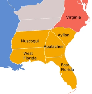
El Gobernador de la Florida residía en San Agustín, y el territorio se dividía en las siguientes provincias administrativas:

  • West Florida, Pensacola
  • East Florida, St. Augustine
  • Lands of Ayllón, Villa Carlos
  • Appalachian Mountains, St. Catherine of Guale
  • Muscogui, Apalachicola
So far, the phase of exploration and conquest of the territory of La Florida can be considered completed .
Spanish Florida (Detail) CtG
In the following 200 years, missions were developed throughout the territory and Spain defended it from attacks from abroad, highlighting the following facts:


At the beginning of the 17th century, 140 missions were built where many indigenous people already expressed themselves and wrote in Spanish.

Towards 1650 the Spanish Administration considered that the evangelization of Florida had been a success, calculating that some 170,000 indigenous people had been baptized and idolatrous and sorcerous practices had been eradicated.

Las misiones al norte de La Florida fueron divididas en cuatro provincias principales, donde tuvo lugar la mayor parte del esfuerzo misionero. Estas fueron Apalachee, Timucua, Mocama y Guale, que correspondían aproximadamente a las áreas donde se hablaban diferentes lenguas entre los pueblos nativos, reflejando por tanto sus territorios.

the-pagum-hispanorum
port of San Agustín in Spanish Florida, according to engraving by Ogilby in 1671
También se establecieron en el sur de la península, en las provincias de Calusa, Tequesta, Ais y Jeaga.

Although the borders were initially delimited from the Atlantic Ocean coast at 36° N (from approximately the latitude of Cape Medanoso, currently called Cape Hatteras ), the Treaty of Madrid of 1670 established the limits between British Virginia and the Spanish Florida at 32° 30" latitude.

As a result, the English advanced to the south, and consolidated their positions by settling in 1670, and definitively, in Charleston (South Carolina).

In 1685, 1,400 people lived in the city of San Agustín .

In 1693, Admiral Andrés De Pez renamed the bay of Santa María de Filipina ( Pensacola ) as Santa María de Galve.

In 1698 the Spanish founded Pensacola. Other cities were San Agustín , Santa Elena and San Luis Talimali
 

Montuno

...como el Son...

(5)- Exploration and conquest of Florida​

Posted on22 February, 2017by laamericaespanyola

n 1698 the Spanish founded Pensacola. Other cities were San Agustín , Santa Elena and San Luis Talimali
strong_03


Beginning in 1680, slave pressure from English settlers in Virginia and the Carolinas began, gradually pushing the Spanish frontiers to the south, while to the west, French settlements along the Mississippi River disrupted land communication . with New Spain.

For nearly 30 years, English and Scottish soldiers from Carolina and their indigenous allies repeatedly attacked the northern Spanish mission towns and the city of San Agustín, burning missions, killing and enslaving the natives of Spanish Florida .

In 1702 the English colonel James Moore and his allies, the Cric Indians , again attacked the Spanish plaza of San Agustín but were unable to gain control of the fort.

In 1704 Moore and his soldiers finished burning the Spanish missions in North Florida and murdered the natives who were friendly with the Spanish.

After the English invasion of the territories, currently corresponding to Georgia , the Spanish remained strong in Vacapilatca (Spanish and Timucua compound word: Vado de las Vacas , Jacksonville since 1822).

During those years, the Muscogui Indians, protected and allied by Spain, began to move to Florida where, mixing with Spaniards, as well as with Appalachians and Africans, they formed the Seminole ethnic group .
sanmarcosdeapalachee


On the other side, on the west coast of Florida in 1719, the French took the Spanish settlement of Pensacola , but had to evacuate it in 1722.

In 1733, the settlement of San Marcos de Apalachee was established in what is now Wakulla County.

In 1738, Florida Governor Manuel de Montiano ordered the construction of Fort Mosé , about 3 km north of St. Augustine, also known by its original name , Fort Gracia Real de Santa Teresa de Mosé . This was the first legal settlement of free blacks on United States soil.


The slaves who managed to flee from the British colonies, Las Carolinas and Georgia , entered the Spanish territory of La Florida , and at Fort Mosé they found refuge and freedom in accordance with Spanish law; the conditions of the British and Spanish slaves were not the same. There is no doubt that the existence of free black men under the Spanish regime encouraged the establishment of that community of Santa Teresa de Mosé. Between 1738 and 1763 , fugitive slaves were arriving from British territories.

For only 20 years, Spain did not have control over Florida when it was ceded to Great Britain between 1763 and 1783 by the Treaty of Paris. During these years, most of the survivors of the indigenous people of Florida who had been devastated by war and disease, left with the Spanish when they left for other territories. Those of the black race went to Cuba, to the city of Matanzas.

In 1781, Bernardo de Gálvez recovered Pensacola in a memorable feat, thereby returning the entire territory to Spain. Florida always belonged to the Viceroyalty of New Spain through the Captaincy General of Cuba .


Economically it was permanently supported by the " situated ", which reached 37,250 pesos in 1585 and stabilized at 64,000 pesos a year from 1600. It came from the New Spain box, through the Royal Treasury of Havana. The military apparatus was established mainly in the following forts:


saint-mark Castillo de San Marcos in San Agustin 250px-ft_matanzas_2008 Fort of Matanzas
  • Castillo de San Marcos in San Agustín 1672
  • Fort of Matanzas in San Agustín in 1742
  • Fort San Carlos of Austria. Pensacola Presidio .
  • Fort San Marcos of Appalachia
  • Presidio of San Luis de Talimali in San Luis de Apalachee
  • Fort of San Miguel de Panzacola (since 1757)
  • Cumberland Island Fort (Georgia)
  • Fort San Carlos of Amelia Island (north Florida)
location-of-archaeological-remains-from-the-spanish-colonial-era-in-florida-637-registered-sites 637 Spanish sites recorded in Florida 1513-1821
Contradicting some sources that question the effective control of Spain over Florida, the attached map shows the multitude of settlements that occurred in its three centuries of history. Almost all empires lay waste to places where others have been great.

The Spanish Crown rejected the colonization model followed by the English in their colonies north of Florida , such as Georgia and the Carolinas , which consisted of displacing the natives from their lands, occupying them, and importing black slaves to work them.

The model of penetration that Spain followed in Florida was the same as in other North American regions: « advanced missionaries accompanied by a patrol of soldiers for their protection ». Then the mission was installed and next to it the fort (presidio).

Despite this, progression was always very difficult in a terrain plagued by impassable swamps, rivers that acted as barriers and impenetrable jungle forests. The extremely rainy weather and the frequent hurricanes in a humid and suffocating environment did not let up either.

The natives that the Spaniards encountered were not peaceful, and their resistance was fierce and tenacious, recognizing that initially they did not act with the necessary intelligence when committing some excessive acts of repression.
flag_of_cross_of_burgundy-svg


They also suffered from the border effect of the English and French colonies. England never ceased in its efforts to expel Spain with continuous incursions, whether clandestine or open. The permanent state of war meant continuous wear and tear for Spain, forced to maintain a firm resistance.

Spain, exhausted and finally harassed by an emerging great power like the United States, insatiable in its expansion, lowered its flag in the castle of San Marcos in Florida on July 17, 1821.

florida.png
 
Last edited:

Montuno

...como el Son...
6-_lpzUw_400x400.jpg

THE POLYGRAPH OF HISTORY

Why did Spain sell Florida?​

The sale of Florida to the United States meant the loss of Spanish protection for the Seminole.​

BY JOSE SEGOVIA

historia-de-espana-florida-tratado-estados-unidos-1.jpg

John Quincy Adams (in the photo) and Luis de Onís signed, in 1821, the treaty by which Spain sold Florida and other territories to the United States.
Monday, January 10, 2022,

AND the effort made by Spain during the War of Independence left its economy in a very precarious state. The monarchy of Fernando VII needed liquidity, and a solution to this problem was to sell Florida to the United States, whose government offered five million dollars for that territory. In fact, Spain already had little power in Florida, whose borders were prowled by Americans hunting and capturing Seminole. Faced with the possibility of not being able to defend it, Madrid decided to start talks with Washington to get some benefit from it.

The sale of Florida to the United States meant the loss of Spanish protection for the Seminole​

Finally, on February 22, 1819, the Spanish diplomat Luis de Onís, representing the Spanish monarch, and Secretary of State John Quincy Adams, representing the United States, signed the Adams-Onís Treaty in Washington. The text began with a pompous phrase that presaged the worst for Madrid's interests: "Wishing Your Catholic Majesty and the United States of America to permanently consolidate the good correspondence and friendship that happily reigns between both parties, they have resolved to compromise and terminate all their differences and pretensions by means of a treaty. Spain lost Oregon, Florida, and Louisiana, but in return gained sovereignty over Texas, though it was barely able to exploit its riches.
After the independence of Mexico, in 1821, it was this country that took control over that territory. While the United States began its journey to become a great world power, Spain sold the land discovered by Ponce de León in 1513 for four bitches. Adams-Onís had another dire consequence for the indigenous people who lived in Florida. The sale of that territory to the United States opened the door to the extermination of the Seminole peoples, who until then had been considered subjects of the Spanish Empire, which gave them a certain degree of citizenship. With Florida in the hands of the United States, the Seminoles were persecuted and practically wiped off the face of the earth.

THE BIG SCAM
Spain never received the promised five million dollars. That money was used to pay US claims against the Spanish monarchy.

ROUND BUSINESS
In addition to getting Florida, Washington got the green light to expand its border to the Pacific above the 42nd parallel.


BDH.png

Tratado de Adam-Onis:
 
Last edited:

Montuno

...como el Son...

elpais.png

This was the colonizers of Spanish Florida​

An investigation led by an academic from the United States rescues names, details and trades of thousands of inhabitants of the peninsula for three centuries​

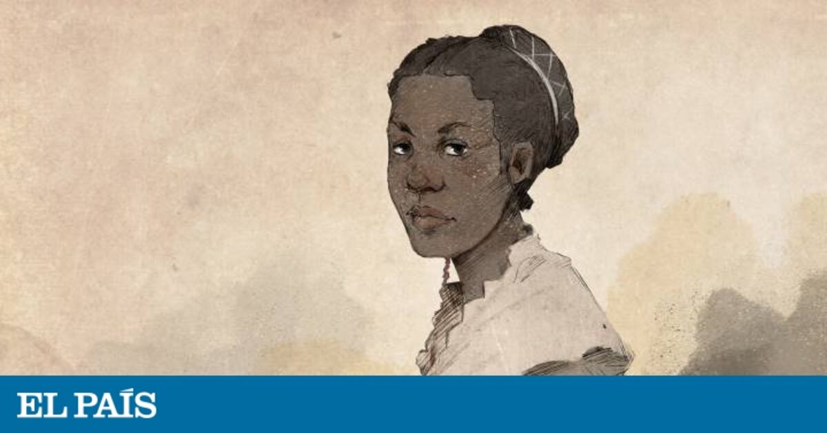
Imaginary portrait of Luisa Ábrego. On video, statements by Professor J. Michael
Screenshot_2022_0417_230626.png

Francis.Video: FLORIDA ARCHIVE
Pablo de Llano

PABLO DE LLANO
Miami-03 APR 2018 -

Professor J. Michael Francis (Calgary, 1967) is a scholar of the history of colonial Florida, of the period in which the Spanish crown ruled the peninsula between 1513 (discovery by Juan Ponce de León) and 1821 (delivery to the United States ). For more than an hour, he unravels over the phone details that are part of the investigation that he has directed and has just presented, Florida: the interactive digital archive of the Americas; a portal in development that draws a portrait of Florida at that time through the biographies of its people.

They have already filed names and details, accessible on the web, of 3,711 settlers in Florida and it is reported that thousands more are missing , "God willing". This Canadian historian from the University of South Florida Saint Petersburg (USFSP), who learned Spanish during a stay in Peru in the 1980s and received a doctorate from Cambridge with a study on New Granada (today Colombia), affirms that "very little is known of the Spanish presence in Florida and, nevertheless, there is an impressive amount of documentation. Despite the fact that it was a border of the Spanish empire, not a center, it was an essential place in the defense policy of the Caribbean of the crown" . He assures that the materials are so many that others could continue their work for decades.

The research to launch the digital archive has lasted two years with Francis as the principal investigator, contributing the baggage of the decade that he had already spent working on these materials, a dozen permanent or collaborating historians –including, from Asturias, Javier Ángel Cancio-Donlebún Ballvé, a direct descendant of the sixth governor of Florida, Gonzalo Méndez de Cancio, and the Spanish technology firm Edriel Intelligence. The main archives from which they are extracting information are that of the parish of San Agustín(the first colonial city in the United States, founded in Florida in 1565, today a historical-tourist attraction), the General de Indias in Seville, Simancas (Valladolid) and the Historic National in Madrid, in addition to other individuals such as the Jesuit of Rome – "great fountain from 1566 to 1572"–.

The greatest finding they have made is that the first Christian marriage on record in the continental United States was between the two Spaniards Miguel Hernández, a white blacksmith and soldier from Segovia, and Luisa Ábrego, a free black woman who had worked as a servant in Jerez de la Frontera.

The data appeared in an investigation for alleged bigamy instructed by the Holy Office of the Inquisition in Mexico in 1575. Ábrego and Hernández arrived together in Florida on the founding expedition of Pedro Menéndez de Avilés (1565) and were married that same year.

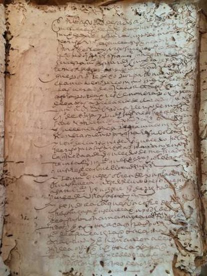
A document from the Cádiz archive from the 16th century

Among the 3,711 settlers already in the database are a wide variety of trades . Browsing by categories, one can, for example, find seven Spanish barbers, a calafate (the one who covered the joints of the wood of the ships with tow and pitch so that water did not enter), six scribes, a shoemaker, four blacksmiths or ten carpenters . In the expedition of Captain Menéndez de Avilés he went to a brewmaster.

"That's what we want," says the historian, "recover stories of unknown people who are the ones who really colonized Florida and had their families there. In the books we call all those who came to this land conquerors, but that word does not capture the complexity and the differences that were between that whole population. We really asked this question: Who were they?"

Another surprising detail that the documentary review has revealed is that the first celebration of Saint Patrick's Day in the United States was in Saint Augustine in the year 1600; 137 years earlier than in Boston. There was a procession and cannons were fired. The reason for this peculiarity: that a governor of Florida took with him from Puerto Rico, as a priest, an Irish friend.

Dr. Francis would like to write a book called The Ten Sixteenth-Century Floridians that would have taken me to the pub. And number one on his list is not a Spaniard but a Portuguese named Pablos Juan who in 1576 denounced a colonial governor "who made him kiss a dog on the ass", was expelled from Florida and reappears in documents from 12 years later in Madrid accusing the Florida authorities of having stolen the crown's money overseas and attributing the looting, to cover up, to the fearsome corsair Francis Drake.

 
Last edited:

Montuno

...como el Son...
About the Native American Tula / Caddo people:

In this current document in English from the Caddo tribe itself, they present and comment on their history up to today,( with some chapters, I believe, dediccated to their interectuations with Hernando de Soto and theitr interaction with Spain) :

https://books.google.com/books/about...d=eYtJfJ9yDEQC

41T33eEPdtL._SX321_BO1,204,203,200_.jpg


Screenshot_2022_0409_233719.png

Pd: the "bloodhounds" dogs, were in reality the ancestors of Álano Español, Cimarrón Uruguayo, Presa Argentino, Presa Canario, y/o Mastín Español Leones dog breds.


250px-Caddoan_Mississippian_culture_map_HRoe_2010.jpg


3e4accd94cf1237f82ba68307966b5df.jpg

CaddoGrassHouses.jpg


2651 (1).jpg


(She looks just like my cousinin by father blood's, Olga, at her age, heh).
Kaw-u-tz_(Cado),_1906 (1).jpg
 
Last edited:

Montuno

...como el Son...

fatapuerca.png

The deposits of the Sierra de Atapuerca​


Sierra de Atapuerca deposits are located about 15 km east of the city of Burgos (Castilla y León, Spain).

They began to have special scientific and social relevance after the discovery of the remains of the Sima de los Huesos in 1992, and the discovery, two years later, of human remains (more than 900,000 years old) that defined a new species known as Homo ancestor . In 2000, UNESCO declared the Sierra de Atapuerca sites a World Heritage Site.

To promote and contribute to this recognition, the Atapuerca Foundation was created on July 26, 1999, at the initiative of the three co-directors of the Project: Juan Luis Arsuaga, José María Bermúdez de Castro and Eudald Carbonell, with the broad objective of supporting and disseminating the Atapuerca Project.

Fossil remains and evidence of the presence of five different hominid species have been found in the Sierra de Atapuerca sites: Homo sp . (yet to be determined, 1,300,000 years), Homo antecesso r (850,000 years), preneanderthal (500,000 years), Homo neanderthalen sis (50,000 years) and Homo sapiens .

More:
https://www.atapuerca.org/es/ficha/Z33D65953-CED4-BE0D-C1BADD13FB257982/balance-de-la-campaña-de-excavaciones-2019-en-los-yacimientos-de-la-sierra-de-atapuerca


Montuno

...como el Son...
unnamed.png


Themes / Paleontology
ATAPUERCA

Atapuerca, the cradle of the oldest humans in Europe :​

In Atapuerca, near Burgos, important fossil remains have been discovered, including those of 'Homo antecessor', a new human species.​

Paleontology Anthropology Atapuerca
Daniel Married Rigalt
updated to November 27, 2020


a05-1174460_1333x2000.jpg

G. AZUMENDI / AGE Fotostock

Excalibur​

500,000-year-old quartzite hand ax found in the Sima de los Huesos. Museum of Human Evolution, Burgos.


spl-e436-071_2000x1358.jpg

SCIENCE PHOTO LIBRARY / AGE Fotostock

Digging in Gran Dolina​

The team of paleontologists excavates in the Gran Dolina, where in 1994 the remains of an unknown human species, Homo antecessor, appeared.


spl-e436-168_2000x1334.jpg

PHOTOSTOCK AGE

the human family​

In the Sima de los Huesos, located at the end of a thirteen meter vertical shaft in the deepest part of the Cueva Mayor, more than 5,000 fossil remains of Homo heilderbergensis of both sexes and different ages were discovered. The lower illustration, the work of the artist Mauricio Antón, recreates a family group of this species, the ancestor of Neanderthal man.


in 1895, a British company began the construction of a railway line to transport iron and coal from the mines in the north of Burgos to the factories in Vizcaya. At one point, the director of the company, an engineer named Richard Preece, modified the initial project so that it would go through a place rich in limestone, in the foothills of the Sierra de Atapuerca .

Preece demolished mountains, carved hills, flattened trees and fitted rails for the mining train to circulate, and thus, without intending to, he uncovered the most important set of paleontological sites in Europe . Today the place is known as the Trench of the Railroad, a one-kilometer-long furrow into which several caves filled with human and animal bone remains open: Sima del Elefante, Galería and Gran Dolina, now open to the public, and Cueva Mayor. , made up of Portalón, Sima de los Huesos and Galería del Sílex, and Mirador, the furthest away; these can only be accessed by researchers.

THE PRECURSORS​

Preece's undertaking was a failure, but when the railway was closed in 1911, numerous fossil remains soon emerged among a phantom landscape of abandoned bridges, embankments and tunnels, attracting illustrious prehistorians such as Hugo Obermaier and Henry Breuil. However, that interest faded and in the 1950s the Railway Trench was transformed into a quarry.
After a few years, in 1964, it was when Professor Francisco Jordá undertook the first archaeological excavations in the Trench of the Railway, work that was continued in the seventies and eighties by the prestigious paleontologist Emiliano Aguirre, a benchmark in Atapuerco chronicles. With Aguirre, the foundations for research in Atapuerca were laid and with him the first project was launched. But Atapuerca's golden age came in the 1990s , when Emiliano Aguirre handed over the baton to a team led by Juan Luis Arsuaga, Eudald Carbonell and José María Bermúdez de Castro.
.
to know more
Agamemnon, the most famous hominin of Atapuerca, was not deaf

Atapuerca's "Agamemnon" was not deaf

read article
.

BONE PARADISE​

The new Atapuerca team raised the deposits in the Sierra de Burgos to world class. Always at the stroke of discovery. It was in 1992 when those responsible for Atapuerca ceased to be anonymous . In that summer of good omens – with the spotlights of half the world pointing to the Olympic Games in Barcelona – one of the caves of Atapuerca, the Sima de los Huesos, returned a bone puzzle that ended up giving shape to two archaic-looking skulls. To scientists they were "skull number 4" and "skull number 5"; They would be popularly known as Agamemón and Miguelón, in homage to Miguel Indurain's second tour. From Miguelón it was possible to reconstruct the body of a hominid ( Homo heidelbergensis) relatively similar to us, 300,000 years old. Atapuerca was first again in 1994, when a fossil male pelvis was recovered from the bowels of the Sima de los Huesos in the middle of summer. Elvis, as he was baptized to make him more familiar to the public, also belongs to a Homo heidelbergensis , like Miguelón and Agamemnon. The Sima de los Huesos finds memorial was completed in 1998 with Excalibur, an exceptional hand axe, in quartzite, which represents the tools of the humans who inhabited the mountains in the Paleolithic.

A NEW HUMAN​

Another of the jewels of Atapuerca is the Gran Dolina, one of the three deposits revealed after the Richard Preece railway fiasco. It includes twenty meters of sedimentary fillings from the Pleistocene (geological stage that ended in 10,000 BC) with the essential paleontological keys to understand human evolution. Its excavation began in 1981, but the day engraved in gold letters in the Gran Dolina is July 8, 1994. On that date, human remains 800,000 years old came to light in what was baptized as the "Aurora stratum": another wink to informative complicity. The aforementioned stratum has been revealed as a true vein. Thousands of years were compacted here until hundreds of stone tools, human fossils and vertebrate bone remains were accumulated, among which a new species of bear baptized asUrsus dolinensis . Three years later, after an exhaustive review of the remains extracted from the "Aurora stratum", the human species had a new member in its family tree: Homo antececessor. Those bones buried in the sand are today one of Atapuerca's greatest claims for what they represent: the oldest known European hominid .
.

to know more
Murder by beating in the Paleolithic

Murder by beating in the Paleolithic

read article
.

FINDINGS FOLLOW​

Other fossils of interest appeared in the Sima del Elefante, where in 2008 remains of a species yet to be defined were discovered, in addition to the oldest stone tools in the entire mountain range. Among the most recent findings, it is worth mentioning a human jaw discovered at level 9 of the Sima del Elefante, in 2011. Although it is still under study, everything indicates that it belongs to the genus Homo sapiens . The news about Atapuerca does not stop. The significance of the findings justifies the great media impact that accompanies each discovery. Since the year 2000, Atapuerca is a World Heritage Site . Without a doubt, it is the cradle of European prehistory, a whole "theme park" of prehistoric science without parallel on the other side of the Pyrenees.

To know more
Atapuerca, lost on the hill. E. Carbonell. Destination, Barcelona, 2004.
Atapuerca and human evolution. JL Arsuaga and I. Martínez. Madrid, Scientific Films, 2009.

 
Last edited:
Microbeman

The Logical Gardener
ICMag Donor
Veteran
Could you elaborate on what is marked in bold?
In what date/epoch would these relations be framed (because they should be before 900 BC)?
Would they be relations with the Olmecs?

I am not an expert on this, but from what I have read about the North American subcontinent, at least since Olmec times, there was (much?) more cultural flow from Mesoamerica to Aridamerica and Osisamerica (from South to North) than the other way around?
In fact the Mexica (Aztecs) migrated from Aridamerica to Mesoamerica, embracing and adapting the culture they found, while the Mesoamerican peoples spoke of them in terms similar to how the Roman world called the Celtic, Germanic, Slavic, Berber...; as "barbarians"...

Translated with www.DeepL.com/Translator (free version)
I will need to search, which is why I only alluded to this. I recall reading and or seeing a documentary hypothesizing a connection between Teotihuacan and structures in Florida and Monks Mound.

If I had the cash, I'd travel to these spots since I'm exactly in the middle of them all.

The theories are that Northern North America was populated via migrations from Russia but I wonder because of the Dene and Navajo similarities in language.
 
Top