What's new
  • ICMag with help from Landrace Warden and The Vault is running a NEW contest in November! You can check it here. Prizes are seeds & forum premium access. Come join in!

Spy Plane Employed To Shame Owners of Heat-loss Homes

Tokabowl

Active member
I saw this in the newspaper a few days ago, thought I would share.

:fsu:


Times said:
Spy plane employed to shame owners of heat-loss homes

Lewis Smith, Environment Reporter


Spy-in-the-sky cameras are being used to identify householders who are wasting the most energy and to shame them into turning the central heating down.

Thermal images of homes have been taken by a light aircraft fitted with military spy technology to record the heat escaping from people’s houses.

Maps identifying individual homes have now been placed on the internet to encourage occupiers to reduce their wastage and carbon emissions by fitting insulation and turning the thermostat down.

Haringey Council, in London, has become the first authority in England to place house-by-house thermal maps on the web, after the example of Aberdeen in Scotland.

Making the information available to the public is intended to raise awareness of how much energy is being used needlessly, putting up bills and contributing to global warming.

It is hoped that homeowners with high wastage levels will be shamed into improving the property’s insulation.

Other authorities have shown interest in the spy technology, including Chester-le-Street District Council, which carried out a survey but has yet to put data on the web, and Norwich, which is considering the idea. It is seen as part of the armoury against global warming, which scientists are convinced is worsening because of man-made carbon emissions.

Haringey’s mapping took place on a winter’s night when households were likely to have the heating turned up high.

An aircraft, fitted with a military-style thermal imager, flew over the borough 17 times to take pictures of almost every house in the area.

Footage of heat loss was converted into stills, then laid over a map of the area, before each house was given colour-coded ratings.

Homes that were losing the most heat were represented as bright red on the map. The least wasteful households were shown in deep blue. Shades of paler blues and reds were used to show grades of heat loss.

Officials from the authority shrugged off suggestions of a Big Brother-style invasion of privacy by prying on people’s properties and then publishing the information.

They said that they hoped to use the maps to pinpoint the homes where grants should be offered and to identify empty properties that could be used to lessen the housing shortage.

Isidoros Diakides, a councillor, said: “This single study will play a key role in helping us address three of the biggest issues currently facing Haringey — climate change, fuel poverty and housing waiting lists.

Robert Wilkes, the owner of hotmapping.co.uk, which conducted the thermal surveys, said: “I think it is less intrusive than Google Earth quite honestly.

“It’s not a photograph; it’s merely a measure of heat loss. I think everybody should find it very useful – particularly businesses, schools and hospitals.”

Haringey’s thermal survey took place in 2000, but fresh spy camera flights took place in March. The heat maps will be updated when the new data have been processed.

Almost 60 per cent of a household’s heat is lost through uninsulated walls and lofts, according to the Energy Saving Trust (EST), costing the average home up to £380 each year.

Insulation is estimated to reduce each home’s carbon emissions by about two tonnes annually.

More than half of the UK’s carbon dioxide emissions come from the domestic sector, taking into account both homes and transport.

Philip Sellwood, chief executive of the EST, welcomed the initiative to reveal the location of wasteful properties.

He said: “By and large we think it’s a good thing, as long as they are following it up with information and advice.

“If they are just doing it to highlight a problem without offering a solution, that’s no good to anyone.”


So in order to fight global warming, lets fly a plane 17 times over the same town and invade poeple's privacy, that's just great...

I wander what else they could be using this for :chin:

Spot the grow house?
colour-bands.gif


More info:
http://www.hotmapping.co.uk/index.htm
http://www.hortonlevi.co.uk/welcome/default.htm
http://www.thermal-imaging-survey.co.uk/index.htm
 
G

Guest

that's ridiculous! :yoinks: what a waste of time and money


at least the thieves won't have to search at random for grow houses anymore :bat:

seriously who would approve something stupid like this, and with the intent to "shame" homeowners, you've got to be kidding me
 

HappyHemphog

Active member
Given this is in the UK, I am not surprised. They already have cameras on just about every street corner and even have ones that will bitch at you for littering!

Just wait till the US hears of this idea, the Bushie types will be ALL over it.

I wonder how much shoulder fired Stingers are going for on the Black Market these days.
 
G

Guest

far as i can tell this was a survey done by an independent company...not the gov't. correct?
 

DickAnubis

Member
Crazy and you're so right Toke,
Airplanes are the biggest detriment, pumping out huge amounts of carbon into the atmos.
And when has shame ever worked on anyone?

PEACE
 

HappyHemphog

Active member
Gelatinous said:
far as i can tell this was a survey done by an independent company...not the gov't. correct?

Correct, but this is exactly how our governments get around not being able to spy on their own citizens, they just contract it out. Bush is a master at this.
 

Tokabowl

Active member
Gelatinous said:
far as i can tell this was a survey done by an independent company...not the gov't. correct?

Yes, from what i gathered that seems to be the case, however, they sell the results obtained, so they could be accessible to anyone who is ready to pay for them...
Surely, this means the gov't can easily have access to the data, thermal imaging of entire towns, without the need to obtain a single warrant...

On the other hand, it also means the homeowners could see the data too (if willing to pay for it), and possibly notice their house has been flagged and do something about it...

Here is from their website:

http://www.hotmapping.co.uk/london/index.htm said:
Hotmapping.co.uk have complete aerial heat-loss data sets of most of London and all of Norwich. Other locations may follow, and specific areas can always be commissioned.

You can get an immediate quote for a colour coded map of any area covered by our data starting from 0.5 sq km. Click here to send us your requirements.

The surveys were carried out in 2000 by Horton Levi Ltd, specialists in thermal imaging. Using military specification equipment and flying at approximately 2000 ft, the images reveal heat loss in remarkable detail.

Thermal data is recorded in monochrome to retain full resolution. Conversion to colour is useful for specific analysis and presentation purposes.

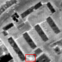
sam01.gif
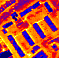
sam01-col.gif


This image clearly highlights an underground heating system. The highlighted area reveals a leak in the system which would otherwise be undetected.

The surveys can be used for many purposes. Housing stock can be analysed for efficiency and larger individual buildings can be analysed for weak insulation points. Heat emissions from factories can be identified and remedial action taken. Housing Associations and local authorities can study their entire stock from one data set. Poorly heated housing can be identified to help prevent winter deaths.


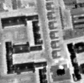
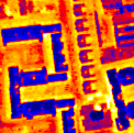
The benefits of insulation programmes can be seen, and housing in need of attention is easily highlighted.

sam02.gif
sam02-col.gif


This data is available now. As well as saving thousands of pounds on commissioning an individual survey, you won't have to wait until next winter which is when further surveys can take place. Data is provided on CD-ROM in monochrome and can be optionally colourised. All the data can be geo-rectified and joined together to provide in a format suitable for your GIS.

Using our therma-spatial analysis system the data can be interpreted and colour coded in your map system. This enables fast analysis of problem buildings. See Services for more details.


Prices depend on the size of the area required - contact us now for an immediate quotation.

:fsu:


HappyHemphog said:
I wonder how much shoulder fired Stingers are going for on the Black Market these days.

250px-Stinger_system.JPG


Range 4,800 meters (15,750 ft.)
Unit cost US$38,000
:biglaugh: :biglaugh: :biglaugh: :biglaugh:
 
Last edited:
G

Guest

wow that really sucks...its weird sometimes i think we have it the worst but man i couldn't live in britain and deal with all those cameras it would just freak me out, i mean the pigs don't even have to catch u speeding over there, its all eye in the sky...brutal...
 

HCSmyth

Member
Why does stuff like this or hydro companies in Canada giving over power usage over to the RCMP happen more over there than in the US?
 

marx2k

Active member
Veteran
Officials from the authority shrugged off suggestions of a Big Brother-style invasion of privacy by prying on people’s properties and then publishing the information.

buh? Eh? Wha? Isnt that exactly what they're doing? I also don't agree with google maps. I feel that homeowners should be asked permission for their home images to be published directly on the internet or in any public forum.

Yet another reason to move away from cities.
 
T

THCV

HCSmyth said:
Why does stuff like this or hydro companies in Canada giving over power usage over to the RCMP happen more over there than in the US?

Well, weed is a $35 billion crop in the US, far bigger than all other crops. Even though the war on drugs is still on, power companies know who pays their bills. $35 billion! Lots of money to be made supplying the power for grows, and powerful companies, when they make lots of money, they lobby to keep making lots of money. No way this thermal shit would go over in the US, and no way private utilities in the US want anyone going after their biggest customers...money talks and bullshit walks in the old US of A. In that sense, it's safer for growers, because of the lobbying clout of power companies. Sad thing is, that same clout will bring global warming ever more rapidly and irreversibly, by delaying the necessary controls on co2 for as long as possible. So grow and blaze while there's still ample water! :moon:

Also, the brits don't have a bill of rights. :yoinks: No privacy! Not sure about canadia, but don't you have the queen on your money?
 

DimeBag65

You will not be forgotten
Veteran
and this isent invading privacy how? "shame them into change" WTF is that shit?

wow we are reaching an interesting time in history, where technology allows for those in power to keep an eye on the comings and goings of its people, and regulate.

Interesting how they slide this by with excuses. what will be next i wonder? :chin:

Dime
 
D

DogBoy

This is nothing compared to the new speaking CCTV.

I was on the fields near my house walking a friends dog last week. I made it to the middle of the field when a booming voice echoed out stating " The police will be called unless you move on ". I thought i was being mobbed at first so i let the dog loose. Shortly after i saw a group of kids running through the trees so it was obviously meant for them but the warning carried a good 3-400 yards. Speaking to my friend about it i find that he can hear the warning at night when the kids are in bed and trying to sleep. It's like those communist control towers you saw in the 50's over in Russia. You cant go anywhere in the UK anymore without someone watching over you and they can now talk to what they see too!

I was encouraged to find though that the kids are now stealing the CCTV units and selling them for profit, way to spend my money Mr Gestapo.
 

Latest posts

Latest posts

Top